
Walk a Washington Township Street
For a Washington Township by-street question, use a short address-to-record sequence. The Franklin County Auditor Address Search supplies the starting parcel, the site address, and owner or property context. Open that parcel in the county map, then carry its legal description into Recorder records. The sequence keeps a street name from doing too much work, especially where a Dublin mailing label, township government, and a county line are all nearby.
- Enter the known number, direction, street name, and unit in the Auditor address search. Leave off the street suffix, as the Auditor instructs.
- Save the returned parcel number, situs address, legal description, and any sale or transfer detail before changing search tools.
- Use the Franklin County Parcel Viewer to identify the parcel and inspect road, parcel, and administrative layers.
- Search the recorded legal description, document number, or party names in the Recorder index to follow an ownership instrument backward.
- For an older address, check whether the appropriate Columbus directory volume includes that address before treating its street listing as an occupant clue.
That workflow identifies address-keyed public records, not every person connected with a street. A result should remain attached to its record type and date.
Washington Township Street Directory Search Fields
The Auditor offers a practical address-search entry point, but its form has its own rules. Street Name Only takes the name without Rd, Ave, Blvd, St, or Pl. A wildcard can broaden a search, yet an inexact result may return as many as 500 rows. Add the number or direction when possible, and use the unit field where it applies. The Auditor also offers owner, parcel, subdivision or condominium, map, intersection, and advanced modes, though a live system-upgrade notice warns that online results can be incomplete.
| Address field | Entry format | Why it matters |
|---|---|---|
| Street No | Text, one criterion required | Narrows a broad street result. |
| Direction | Optional dropdown | Separates directional forms of a street name. |
| Street Name Only | Text without suffix | *High finds streets named High; S *High narrows to South High. |
| Unit | Optional text | Adds a unit component when known. |
| Sort and result controls | Parcel ID, address, unit, owner, or legal | Helps inspect a bounded set rather than a broad wildcard list. |
See the county’s address-search form before entering a street. Its instructions and fields are the source for the capture below.
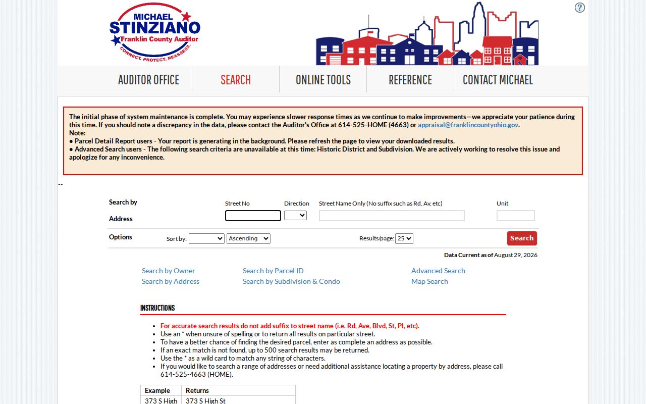
The form separates number, direction, name, and unit, which makes a precise street search more reliable than pasting a full address into one field.
When the expected result is missing, the Auditor asks users to contact the office at 614-525-4663 or appraisal@franklincountyohio.gov. The public information counter is at the county complex on South High Street. The Treasurer property search, which accepts name, street address, and parcel ID, is a useful tax-side cross-check while the main property interface is under maintenance.
Note: Record the date of each property result because the Auditor cautions that its online system can return incomplete data during the upgrade.
Map Washington Township Street Directory Parcels
The street search becomes more dependable after the address is mapped to a parcel. The Parcel Viewer can find a parcel by shape, by value, or through a map identify action, then link to property detail. Its documented layers include road centerlines, parcel labels, administrative areas, tax and school districts, city or village boundaries, and ZIP boundaries. A researcher looking at a segment can draw an area, or find one parcel first and use By Spatial to make a distance buffer.
The map tool can return parcels completely inside or intersecting a selected buffer and can export the result list to CSV. That is a geographic working list, not a roll of people. Open the individual parcel records before drawing a conclusion from any row. The county’s advanced search is another way to inspect available property criteria, although its dynamic criteria controls did not expose a verified ZIP search at inspection.
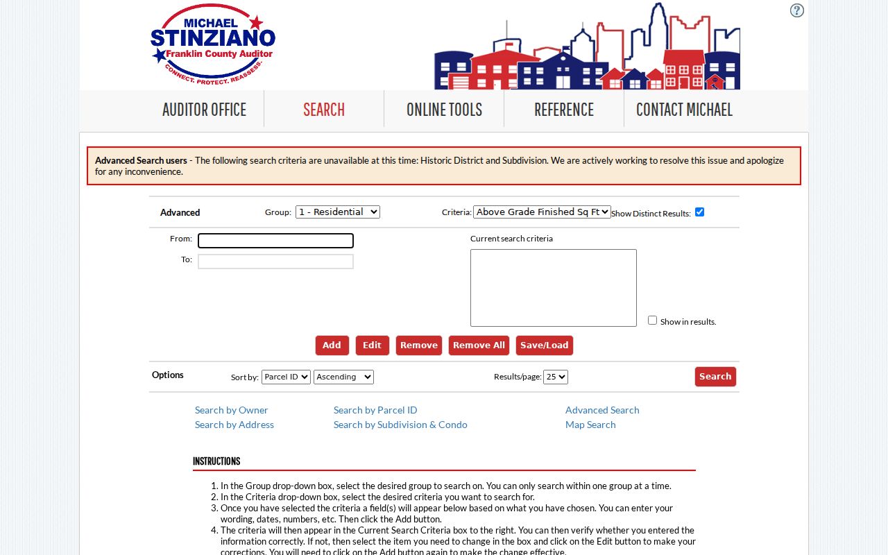
The advanced screen is useful for understanding the Auditor’s separate search modes, but the county documentation does not establish it as a ZIP-wide street or resident query.
Washington Township Address Record Coverage
Each source answers a narrower question. Pair the parcel and legal description with the source that actually keeps the relevant record. The property roll provides current parcel context, while the Recorder provides the instrument trail. The voter system is an individual confirmation tool and is not a browseable street list.
| Address-keyed source | Custodian | Street directory value | Access and limit |
|---|---|---|---|
| Property card | Franklin County Auditor | Parcel, owner, situs, valuation, sale and map context | Address, owner, parcel, map, and advanced search; not a complete occupancy record. |
| Tax detail | Franklin County Treasurer | Tax district, owner, payments, rates, and assessments | Name, street, or parcel search; correspondence address can differ from situs. |
| Parcel Viewer | Auditor GIS | Parcel geography, nearby lots, layers, and property-detail link | Free map and CSV export; no person list. |
| Recorded instruments | Franklin County Recorder | Grantor, grantee, dates, legal description, plats, and document path | Cloud, legacy index, counter, or copy request; older street forms can fail. |
| Permit or zoning file | County, township, or Dublin custodian | Project or inspection record when held | No verified public historical address index. |
| Street section | Columbus Metropolitan Library | Dated listed occupant for included directory areas | Begins in 1911; an entry is not proof of ownership. |
A tax mailing address is where an owner or recipient receives correspondence. It is not proof that the person is at the situs address. The same care applies to a property owner name and to an old directory listing.
Washington Township Parcel Jurisdiction Clue
The Township’s local zoning FAQ provides an unusually useful street-level branch. Franklin County parcel numbers beginning 270, 271, or 272 are generally in unincorporated Washington Township for zoning. Prefixes 273, 274, or 275 can fall in both the township and the City of Dublin, and Dublin zoning applies when the parcel is inside the city. Check the actual parcel and map layer before choosing a permit, zoning, code, or records-request custodian.
The Washington Township zoning FAQ is the source for that distinction and for the county building-permit contact route.
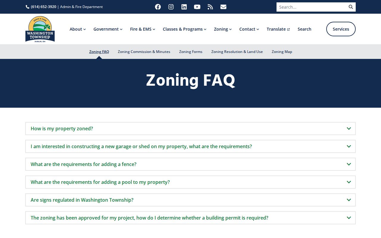
For unincorporated land, the Township is the zoning contact; building permits and inspections go through the Franklin County Building Department. A parcel inside Dublin may instead require the City’s records route. No reviewed source establishes a searchable historical permit index, so ask the relevant custodian for a defined address, date range, and record type.
Follow Washington Township Street Directory Deeds
The Recorder is where an address trail turns into a document trail. In Cloud Search, a modern search can use party name, date, document number, book, volume, page, subdivision legal, or freeform legal fields. Start with the current parcel’s legal description or current owner, then confirm that the matching instrument describes the same lot or subdivision. The Recorder can help with the search site but does not perform a title search or give a legal ownership opinion.
The Recorder advanced search displays separate grantor and grantee fields, date controls, document filters, historical placement fields, and index-only or index-plus-OCR search choices.
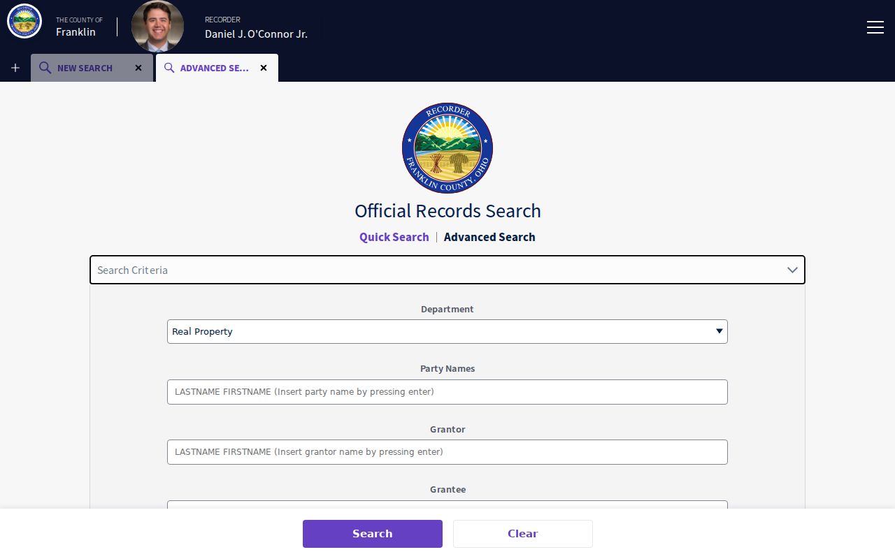
Search the current owner as a grantee to locate an acquisition, then check the seller as a grantee for an earlier acquisition. Compare the legal description at each handoff rather than assuming an unchanged street number proves a match.
Cloud Search is free to search. An unofficial copy may be printed from the online record. Certified copies can be requested online, by mail, or in person from the Recorder, and the research records the stated cost as $2 per page plus $1 certification per document.
Washington Township Address Keys Explained
Three terms keep an address-record search from joining unrelated records. Use them together when an address appears differently in a map, tax record, or deed.
- Parcel
- A county-defined piece of land with its own parcel number. It connects the property search, map, and tax context.
- Situs address
- The physical address of the parcel. It is the address used by the Auditor’s address search and can differ from a correspondence address.
- Legal description
- The lot, block, subdivision, or other land description in a recorded instrument. It is the safer bridge when street formatting has changed.
- Plat
- A recorded map or plan that lays out lots, boundaries, or a subdivision. It can connect new street numbering to the underlying land.
- Criss-cross directory
- A directory section arranged by street address rather than alphabetically by name. CML’s Columbus street section begins in 1911.
These keys are also helpful where an old instrument has no modern street number. A subdivision name or lot and block may make the connection that a street-only search cannot.
Washington Township Street Index Eras
Franklin County has two deed-index eras that should not be treated as one seamless online result. The Recorder guide directs research from 1804 through 1913 to the legacy archival deed indexes, where the researcher chooses a grantor or grantee index, uses leading surname letters and a handwritten-index page, and then follows the listed volume and page. Modern deed-index coverage begins January 2, 1914. The older workflow is a different retrieval path, not proof that no pre-1914 document exists.
For an early gap, use the Recorder’s office or archival route rather than ending the address trail. Some county records were destroyed in the 1879 fire, but the Recorder says most were reconstructed. Preserve book, page, legal description, and source reference so a counter or archive search can resume from the same point.
Note: A first matching deed does not complete a title chain because estates, refinances, corrections, trusts, plats, and parcel splits can alter the record path.
Washington Township Street Boundary Changes
A road or Dublin mailing label does not settle jurisdiction. Washington Township reaches across Franklin, Delaware, and Union counties, so the Franklin County tools discussed here apply only after the parcel is verified in the county. Franklin County Resolution 0088-25 approved a February 2025 annexation of about 104.5 acres from Washington Township to Dublin. Older property, planning, zoning, or directory wording may therefore differ from a current local label.
Carry the parcel number and legal description across that change. For current city-held material, Dublin uses a public-record request channel; for township-held material, identify the specific record and request it under Ohio Public Records Act, ORC 149.43. The Township source did not establish a historic permit-index coverage date, so an address conversion or permit claim should be verified with the custodian.
Earlier Washington Township Street Occupants
For a dated occupant lead, Columbus Metropolitan Library’s Main Library holds annual Columbus City Directories from 1841, with a house-by-street-address section beginning in 1911. Before using that feature for Washington Township, confirm that the particular volume covers the address. The library warns that a listed occupant is not necessarily the owner, and the collection is Columbus-focused rather than a complete township-wide roll.
The digitized collection is still growing and includes early Franklin County telephone directories. The historical collections themselves are described on the Washington Township historical city directory page; use the relevant street section as one dated source alongside the parcel and deed trail. CML’s Local History and Genealogy staff, its house-history assistance, and its Main Library shelf provide the documented access alternatives when a volume is not online.
Washington Township Street Voter Limits
Ohio’s My Voter Information tool is designed for an individual registration check. It requires first name, last name, and county, and can ask a matched user to narrow by street name. It is not a public browse screen for a named street. The Franklin County Board of Elections is the appropriate custodian for a defined election record request, and it can apply the exclusions in ORC 3503.13.
Those exclusions include protected registration records and specified personal fields. A polling place or nearby result cannot establish who is at a particular address. If the question becomes one person’s record rather than a street chain, use the separate Washington Township resident lookup workflow and compare at least two independent records.
Washington Township Street Directory Limits
Property, tax, map, deed, and directory material identify different things. An owner field identifies a party in a property record. A mailing field identifies correspondence. A directory entry identifies a listed occupant at a publication date. Neither record proves every current person at an address, and none should be combined into a public street-wide list. Safe at Home participants and other protected records can also be absent or redacted.
Lawful use. Use Washington Township address records for personal, family-history, property, estate, or civic research. Do not use record details to stalk, harass, intimidate, or harm anyone.
When a record is unavailable online, request the specific document from the office that keeps it. Ohio Public Records Act requests can be made for inspection or copies, subject to lawful exemptions and actual duplication or delivery costs.